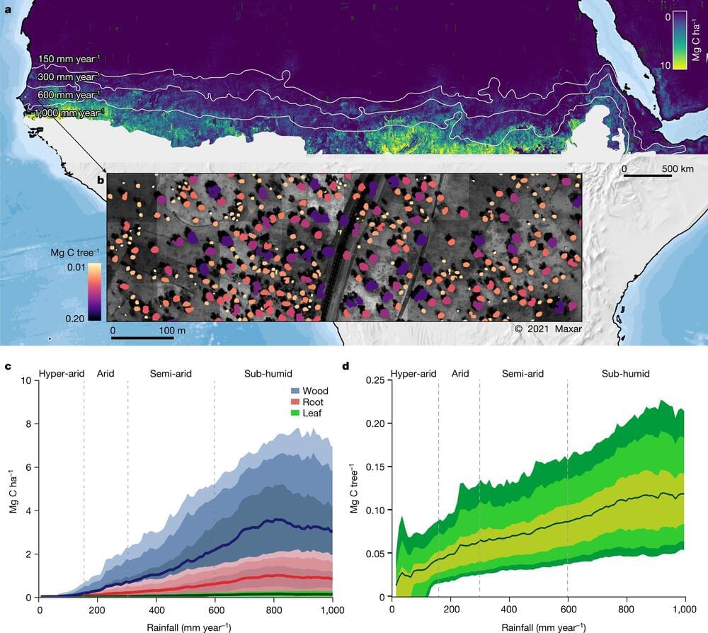
A NASA-led research team used satellite imagery and artificial intelligence methods to map billions of discrete tree crowns down to a 50-cm scale. The images encompassed a large swath of arid northern Africa, from the Atlantic to the Red Sea. Allometric equations based on previous tree sampling allowed the researchers to convert imagery into estimates of tree wood, foliage, root size, and carbon sequestration.
The new NASA estimation, published in the journal Nature, was surprisingly low. While the typical estimation of a region’s carbon stock might rely on counting small areas and extrapolating results upwards, the NASA demonstrated technique only counts the trees that are actually there, down to the individual tree. Jules Bayala and Meine van Noordwijk published a News & Views article in the same journal commenting on the NASA team’s work.
The initial expectation of counting every scattered tree, in areas that previous models often represented by zero values, was erased by large overestimations in other areas of the earlier assessments. In previous attempts using satellites, cropland, and ground vegetation adversely affected optical images. If radar was used, topography, wetlands, and irrigated areas affected the radar backscatter, predicting higher carbon stocks than the current NASA estimations.


Comments are closed.